Advanced coordinate conversion#
This tutorial delves deeper into conversions between geographic coordinates and HEALPix indices, exploring the different indexing schemes.
HEALPix indexing schemes#
HEALPix supports three different indexing schemes:
nested
ring
zuniq
Conversions from geographic coordinates index#
Nested and Ring#
import numpy as np
from healpix_geo.nested import lonlat_to_healpix as nested_lonlat
from healpix_geo.ring import lonlat_to_healpix as ring_lonlat

# Same point, two schemes
lon, lat = np.array([0.0]), np.array([45.0])
depth = 8

ipix_nested = nested_lonlat(lon, lat, depth, "WGS84")
ipix_ring = ring_lonlat(lon, lat, depth, "WGS84")

print(f"Point (0°, 45°) at depth={depth}:")
print(f"  Nested: {ipix_nested[0]}")
print(f"  Ring:   {ipix_ring[0]}")
Point (0°, 45°) at depth=8:
  Nested: 43775
  Ring:   115680
Warning
The nested and ring indices are not interchangeable. The same point has different indices depending on the scheme!
Nested and Zuniq#
from healpix_geo.zuniq import from_nested, to_nested
import numpy as np

# Nested → Zuniq
ipix_nested = 349440
depth = 8
zuniq_id = from_nested(ipix_nested, depth)

print(f"Nested (depth={depth}, ipix={ipix_nested}) → Zuniq: {zuniq_id}")

# Zuniq → Nested
ipix_back, depth_back = to_nested(zuniq_id)
print(f"Zuniq {zuniq_id} → Nested (depth={depth_back}, ipix={ipix_back})")
Nested (depth=8, ipix=349440) → Zuniq: [3073711143726874624]
Zuniq [3073711143726874624] → Nested (depth=[8], ipix=[349440])
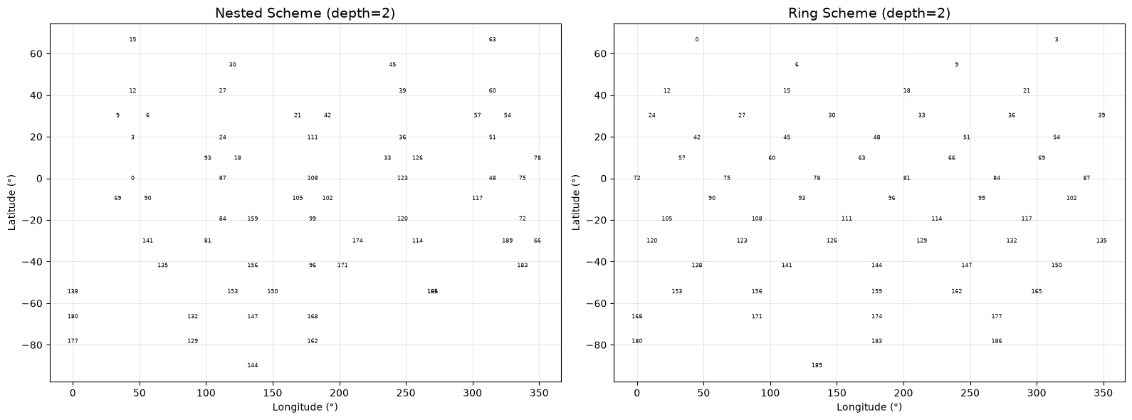
Visual comparison#
Let see how the different schemes are organising cells :
Choice Table#
Need |
Recommended Scheme |
|---|---|
General Application |
nested |
Hierarchical Navigation |
nested |
Spherical harmonics |
ring |
MOC |
zuniq |
Order by latitude |
ring |
Next Steps#
Cover Requests
Working MOC
Performance
Hierarchy